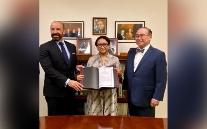
PH-INDONESIA EEZ PACT. Foreign Affairs Secretary Teodoro Locsin, Jr. (right) and Indonesian Foreign Minister Retno Marsudi submit the official copy of the 2014 agreement establishing the boundary between the Philippines and Indonesia's overlapping exclusive economic zones and respective instruments of ratification to UN Undersecretary-General for Legal Affairs Miguel de Serpa Soares (left) at the UN Headquarters in New York last week. The agreement was formally signed by the two countries in May 2014 in Manila and was ratified by President Rodrigo R. Duterte in February 2017 and by the Indonesian Parliament in April 2017. (Photo courtesy of the Department of Foreign Affairs)
MANILA -- Foreign Affairs Secretary Teodoro Locsin, Jr. on Wednesday said the Philippines and Indonesia's recent submission of the 2014 agreement establishing the boundary between their overlapping exclusive economic zones (EEZs) to the United Nations showed that bilateralism works.
In recalling his recent dialogue with former Australian Prime Minister Kevin Rudd about overlapping EEZs, Locsin said there is a way to settle the issue without surrendering claims.
"I had no answer then I remembered this: 'Yes, Indonesia and I found it, but it took 14 years to happen,'" he said, referring to the two nations' joint submission of the 2014 bilateral agreement last September 27.
Locsin said '"sometimes bilateralism works" when bilateral dialogue partners "show mutual respect".
The official copy of the agreement and respective instruments of ratification were submitted by Locsin and Indonesian Foreign Minister Retno Marsudi to UN Undersecretary-General for Legal Affairs Miguel de Serpa Soares at the UN Headquarters in New York last week.
The submission follows the ceremonial exchange of ratification instruments by the two foreign ministers at the 52nd ASEAN Foreign Ministers’ Meeting on August 1, which effectively put into force the bilateral maritime border delimitation agreement.
The agreement, which was first discussed in June 1994, was formally signed by the two states in May 2014 in Manila. It was ratified by President Rodrigo R. Duterte in February 2017 and by the Indonesian Parliament in April 2017.
The Philippines completed its two-step domestic procedure in June when the Philippine Senate concurred with the executive ratification.
Both countries are parties to the 1982 United Nations Convention on the Law of the Sea (UNCLOS) and are entitled to EEZs of 200 nautical miles.
Under the said convention, states have sovereign rights to explore and exploit, and conserve and manage natural resources, within their EEZ.
The Philippines and Indonesia have overlapping EEZs in the Mindanao and Celebes Seas, and in the southern section of the Philippine Sea in the Pacific Ocean.
According to the Department of Foreign Affairs, the National Mapping and Resource Information Authority of the Department of Environment and Natural Resources and its Indonesian counterpart, the Geospatial Information Agency and the Hydro-Oceanographic Office of the Indonesian Navy, will meet soon to determine the actual delineation of the sea points and geodetic lines between the two countries.
"The agreement is expected to benefit both countries, economically and politically, by promoting more bilateral cooperation in order to advance the common interest of managing and preserving the resources in the EEZ and further strengthening maritime security cooperation between the two countries," it said. (PNA)
