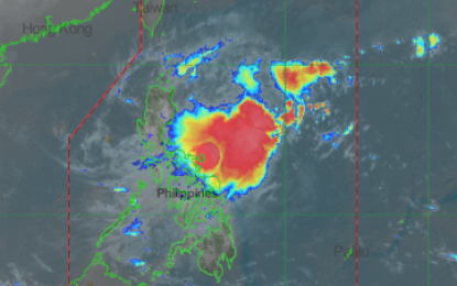
Satellite image from PAGASA
MANILA -- Tropical Cyclone Wind Signal No. 1 is hoisted in three areas Wednesday as tropical depression "Ramon" slightly accelerates and moves northwest.
In its 5 a.m. severe weather bulletin, the Philippine Atmospheric, Geophysical and Astronomical Services Administration (PAGASA) said TCWS No. 1 is hoisted over Catanduanes, Eastern Samar and the eastern portion of Northern Samar.
Light to moderate with occasional heavy rains may be experienced over Catanduanes, Camarines Sur, Albay and Sorsogon.
Light to moderate with intermittent heavy rains are expected over Camarines Norte, Masbate, Northern Samar and Eastern Samar.
At 4 a.m. Wednesday, Ramon was last observed at 515 kilometers east of Borongan, Eastern Samar with maximum sustained winds of 55 kilometers per hour (kph) near the center, gustiness of 70 kph and is moving west northwest at 15 kph.
TCWS No. 1 may also be raised over Camarines Sur, Albay, Sorsogon and the rest of Northern Samar.
Sea travel is risky, especially for small sea crafts, over the seaboards of Northern Luzon, and the eastern seaboards of Central and Southern Luzon due to prevailing or forecast rough sea conditions.
Ramon is forecast to intensify into a tropical storm within the next 24 hours.
Metro Manila, Ilocos Region, Cordillera Administrative Region, Cagayan Valley and Central Luzon will have cloudy skies with light rains due to localized thunderstorm.
Temperature in Metro Manila ranges from 24-30 degrees Celsius; Tuguegarao City 21-28 degrees Celsius; Baguio City 14-21 degrees Celsius; Metro Cebu 25-32 degrees Celsius, and Metro Davao 25-34 degrees Celsius. (PNA)
