(Photo courtesy of PAGASA)
MANILA – Tropical Cyclone Wind Signal (TCWS) No. 4 has been raised over the province of Catanduanes and the eastern part of Camarines Sur as Typhoon ‘Rolly’ (international name Goni) continues to move towards the Bicol Region.
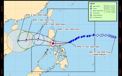
In its severe weather bulletin on Saturday night, the Philippine Atmospheric, Geophysical and Astronomical Services Administration (PAGASA) spotted ‘Rolly’ at 280 km. east northeast of Virac, Catanduanes.
Rolly maintained its strength with maximum sustained winds of up to 215 km. per hour (kph) near the center and gustiness of up to 265 kph.
Moving west southwest at 20 kph, the typhoon will hit Catanduanes early Sunday and will pass over the Camarines provinces and the province of Quezon in the afternoon through evening.
The typhoon is forecast to cross the Southern Luzon - Metro Manila area and is expected to exit Luzon’s landmass early Monday.
Aside from Catanduanes, TCWS No. 4 (171-220 kph winds prevailing or expected in 12 hours) is hoisted over the towns of Siruma, Tinambac, Goa, Lagonoy, San Jose, Garchitorena, Presentacion, and Caramoan in Camarines Sur.
TCWS No. 3 (121-170 kph winds prevailing or expected in 18 hours) is hoisted over Camarines Norte, the rest of Camarines Sur, Albay, Sorsogon, Burias and Ticao Islands, Marinduque, and the southern portion of Quezon (Atimonan, Pagbilao, Padre Burgos, Agdangan, Unisan, Plaridel, Gumaca, Pitogo, Macalelon, Lopez, General Luna, Catanauan, Mulanay, San Francisco, San Andres, San Narciso, Buenavista, Guinayangan, Tagkawayan, Calauag, Quezon, Alabat, Perez), and Northern Samar.
Meanwhile, TCWS No. 2 (61-120 kph winds prevailing or expected in 24 hours) is in effect over Pampanga, Bulacan, the southern portion of Nueva Ecija (Cabiao, San Isidro, Gapan City, General Tinio, Peñaranda, San Antonio, Jaen, San Leonardo, Santa Rosa, Cabanatuan City, Palayan City, Laur, Gabaldon, Bongabon), the southern portion of Zambales (San Marcelino, San Felipe, San Narciso, San Antonio, Castillejos, Subic, Olongapo City), Bataan, Metro Manila, Rizal, Cavite, Batangas, Laguna, the southern portion of Aurora (Maria Aurora, San Luis, Baler, Dingalan), the rest of Quezon including Polillo Islands, the rest of Masbate, Romblon, Oriental Mindoro, and Occidental Mindoro including Lubang Island; the northern portion of Samar (Catbalogan City, Jiabong, Motiong, Paranas, Hinabangan, San Sebastian, Tarangnan, San Jorge, San Jose de Buan, Matuguinao, Gandara, Santa Margarita, Calbayog City, Santo Nino, Almagro, Tagapul-An), the northern portion of Eastern Samar (San Julian, Sulat, Taft, Can-Avid, Dolores, Maslog, Oras, San Policarpo, Arteche, Jipapad),and the extreme northern portion of Antique (Pandan, Libertad, Caluya), and the northwestern portion of Aklan (Buruanga, Malay, Nabas, Ibajay).
TCWS No. 1 is raised over the rest of Zambales, Tarlac, the rest of Nueva Ecija, the rest of Aurora, Pangasinan, La Union, the southern portion of Ilocos Sur (Quirino, Gregorio Del Pilar, Salcedo, San Emilio, Candon City, Galimuyod, Santa Lucia, Cervantes, Sigay, Santa Cruz, Suyo, Tagudin, Alilem, Sugpon), Mountain Province, Benguet, Ifugao, Nueva Vizcaya, Quirino, the central and southern portions of Isabela (Mallig, Quirino, Ilagan, Roxas, San Manuel, Burgos, Gamu, Palanan, San Mariano, Benito Soliven, Naguilian, Reina Mercedes, Luna, Aurora, Cabatuan, San Mateo, Cauayan City, Dinapigue, San Guillermo, Echague, San Agustin, Jones, Angadanan, Alicia, San Isidro, Ramon, Santiago City, Cordon), and Calamian Islands, Biliran, the northern portion of Antique (Sebaste, Culasi), the rest of Aklan, the northern portion of Capiz (Jamindan, Mambusao, Sapi-An, Ivisan, Roxas City, Panay, Pilar, Sigma, Dao, Panitan, Pontevedra, President Roxas), and the northern portion of Iloilo (Carles, Balasan, Estancia, Batad).
Light to moderate with at times heavy rains are expected over Bicol Region, Visayas, and Quezon brought by Rolly’s outer rain bands.
On Sunday morning, Rolly will dump heavy to intense rains over Metro Manila, Bicol Region, Calabarzon, Aurora, Bulacan, Zambales, Bataan, Marinduque, Romblon, Occidental Mindoro, and Oriental Mindoro.
Moderate to heavy rains with at times intense rains will be experienced over Cagayan Valley, Cordillera Administrative Region, Ilocos Region, and the rest of Central Luzon. Flooding (including flash floods), rain-induced landslides, and sediment-laden streamflows (i.e. lahar) may occur during heavy or prolonged rainfall especially in areas that are highly or very highly susceptible to these hazards.
Meanwhile, the center of tropical depression ‘Atsani’ was estimated at 1,480 km. east of southern Luzon.
It currently has maximum sustained winds of 55 kph and gustiness of up to 70 km/h. It is moving northwestward at 25 kph. It would be given the local name ‘Siony’ once it enters the Philippine Area of Responsibility by Sunday afternoon. (PNA)
