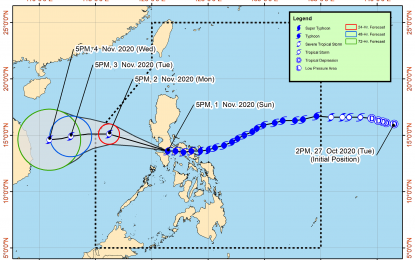
MANILA – Typhoon Rolly (international name Goni) continues to weaken and is now over the West Philippine Sea, the weather bureau said on Sunday night.
In its 8 p.m. bulletin, the Philippine Atmospheric, Geophysical and Astronomical Services Administration (PAGASA) said "Rolly" made landfall in the vicinity of Lobo, Batangas at 5:30 p.m. Sunday.
“'Rolly" will move generally west-northwestward or westward while moving over the West Philippine Sea. It may exit the Philippine Area of Responsibility (PAR) by Tuesday morning. "Rolly" is forecast to weaken into severe tropical storm category in the next 24 hours," PAGASA said.
Despite the typhoon's exit from the country's landmass, it would bring moderate to heavy with at times intense rains over Aurora and the eastern portions of mainland Cagayan and Isabela.
Light to moderate with at times heavy rains will be experienced over Metro Manila, Calabarzon, Cordillera Administrative Region, Ilocos Region, Mimaropa, Western Visayas, Zamboanga Peninsula, Bangsamoro, Northern Mindanao, and the rest of mainland Cagayan Valley and Central Luzon.
PAGASA warned the public against flash floods, rain-induced landslides, and sediment-laden streamflows like lahar which may occur during heavy or prolonged rainfall especially in areas that are highly or very highly susceptible to these hazards.
It added that destructive typhoon-force winds will be experienced in areas under Tropical Cyclone Wind Signal (TCWS) No. 3, damaging gale- to storm-force winds in areas under TCWS No. 2, and strong breeze to near gale conditions in areas under TCWS No. 1.
Storm warning signals elsewhere have been lowered or lifted.
TCWS No. 3 is hoisted in the southwestern portion of Batangas (Tingloy, Mabini, Bauan, San Luis, Taal, Santa Teresita, Alitagtag, Taal lake, San Nicolas, Talisay, Laurel, Agoncillo, Lemery, Calaca, Balayan, Tuy, Nasugbu, Lian, Calatagan) and the northwestern portion of Occidental Mindoro (Abra de Ilog, Mamburao, Paluan) including Lubang Island
TCWS No. 2 is in effect over Cavite, the rest of Batangas, the northern portion of Oriental Mindoro (Puerto Galera, San Teodoro, Baco, Calapan City, Naujan, Victoria, Pola)
and the central portion of Occidental Mindoro (Santa Cruz, Sablayan)
TCWS No. 1 is hoisted in the southern portion of Zambales (San Marcelino, San Felipe, San Narciso, San Antonio, Castillejos, Subic, Olongapo City), Bataan, Bulacan, Pampanga, Rizal, Laguna, Metro Manila, the rest of Occidental Mindoro, the rest of Oriental Mindoro, Calamian Islands, Marinduque and Quezon including Polillo Islands
As of 7 p.m. Sunday, the eye of "Rolly" was located based on all available data at 120 km West of Calapan City, Oriental Mindoro with maximum sustained winds of 125 km. per hour (kph) near the center and gustiness of up to 170 kph. It is moving west at 25 kph. (PNA)
