MANILA – “Ulysses” is forecast to intensify into a severe tropical storm in the next 24 hours, the weather bureau said Monday night.
In its 11 p.m. bulletin, the Philippine Atmospheric, Geophysical and Astronomical Services Administration (PAGASA) said the storm may reach typhoon category Wednesday morning and reach its peak intensity of 140-155 km/hour on Wednesday evening.
“This tropical cyclone may make landfall at or near its peak intensity,” PAGASA said.
At 10 p.m. Monday, the center of Tropical Storm "Ulysses" was estimated at 485 km East of Borongan City, Eastern Samar or 560 km East of Catarman, Northern Samar.
It has maximum sustained winds of 65 km/hour near the center and gustiness of up to 80 km/hour.
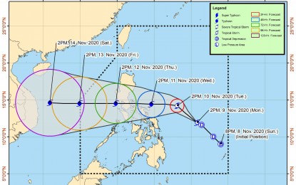
“On the forecast track, Tropical Storm “Ulysses” will move generally northwestward or west-northwestward Monday night through Tuesday evening, then turn westward beginning Tuesday evening,” it added.
The center of “Ulysses” is more likely to make landfall over Quezon between the morning of Nov. 11 and 12. Given the current spread of the track forecast, however, a landfall over the Bicol Region at around Wednesday afternoon or evening remains a possibility.
Tropical Cyclone Wind Signal no. 1 has been raised in the following areas: the eastern portion of Camarines Sur (Siruma, Tinambac, Goa, Tigaon, Sagnay, San Jose, Lagonoy, Garchitorena, Presentacion, Caramoan); the eastern portion of Albay (Tiwi, Malinao, Tabaco City, Malilipot, Santo Domingo, Bacacay, Rapu-Rapu, Manito); Catanduanes; and the northeastern portion of Sorsogon (Sorsogon City, Gubat, Prieto Diaz).
Affected areas in the Visayas include the eastern portion of Northern Samar (Laoang, Palapag, Mapanas, Gamay, and Lapinig). (PNA)
