(Image grabbed from PAGASA website)
MANILA – Intense rains are forecast to continue over parts of the Bicol Region as Typhoon Ulysses further intensified, the weather bureau said in its 2 p.m. bulletin.
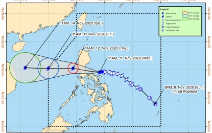
The typhoon now packs a maximum sustained winds of 135 kph near the center, and gustiness of up to 165 kph. It was last seen 125 km north Northwest of Virac, Catanduanes or 95 km. northeast of Daet, Camarines Norte.
The Philippine Atmospheric, Geophysical and Astronomical Services Administration (PAGASA) forecast destructive winds and intense with at times torrential rainfall over the northern portions of Catanduanes, Camarines Sur, and Camarines Norte until Wednesday night, and over Aurora and northern portion of Quezon until Thursday.
Tropical cyclone wind signal (TCWS) no. 3 is still hoisted over the southern portion of Quirino (Maddela, Nagtipunan), the southern portion of Nueva Vizcaya (Alfonso Castaneda, Dupax Del Norte, Dupax Del Sur), Pangasinan, Nueva Ecija, Aurora, Tarlac, Zambales, Bataan, Pampanga, Bulacan, Metro Manila, Rizal, Cavite, Laguna, the northern and central portions of Quezon (General Nakar, Infanta, Real, Mauban, Sampaloc, Lucban, Tayabas City, Sariaya, Candelaria, Dolores, Tiaong, San Antonio, Lucena City, Pagbilao, Atimonan, Padre Burgos, Unisan, Agdangan, Gumaca, Plaridel, Pitogo, Macalelon, Lopez, General Luna, Catanauan, Buenavista, Guinayangan, Tagkawayan, Calauag, Quezon, Alabat, Perez) including Polillo Islands, Batangas, Catanduanes, Camarines Norte, the northern portion of Camarines Sur (Del Gallego, Ragay, Lupi, Sipocot, Cabusao, Bombon, Calabanga, Tinambac, Siruma, Goa, Lagonoy, San Jose, Garchitorena, Presentacion, Caramoan). Destructive typhoon force winds will be experienced in these areas.
The rest of Quirino, the rest of Nueva Vizcaya, the southern portion of Benguet (Bokod, Itogon, Tublay, La Trinidad, Sablan, Baguio City, Tuba), the southern portion of La Union (Burgos, Naguilian, Bauang, Caba, Aringay, Tubao, Pugo, Santo Tomas, Rosario, Agoo), the rest of Quezon, Marinduque, the northern portion of Occidental Mindoro (Paluan, Abra de Ilog) including Lubang Island, the northern portion of Oriental Mindoro (Pola, Victoria, Naujan, Baco, Calapan City, San Teodoro, Puerto Galera), the rest of Camarines Sur, Albay, Sorsogon, and Burias and Ticao Islands are still under TCWS no. 2. Damaging gale force to storm force winds will prevail in these areas.
Areas under TCWS no. 1 are Isabela, Kalinga, Mountain Province, Ifugao, the rest of Benguet, Abra, Ilocos Sur, the rest of La Union, the rest of Occidental Mindoro, the rest of Oriental Mindoro, Romblon, the rest of Masbate, northern Samar, the northern portion of Samar (Santo Nino, Almagro, Tagapul-An, Tarangnan, Calbayog City, Santa Margarita, Gandara, Pagsanghan, San Jorge, San Jose de Buan, Matuguinao), and the northern portion of Eastern Samar (Maslog, Dolores, Oras, San Policarpo, Arteche, Jipapad).
Moderate to heavy with at times intense rains over Albay, Sorsogon, Quezon including Polillo Islands, and Burias and Ticao Islands.
Light to moderate with at times heavy rains will prevail over Metro Manila and the rest of Luzon and Visayas.
Rough to very high seas will be experienced over the seaboards of areas under TCWS, and the eastern seaboard of Eastern Samar currently not under TCWS no. 1.
Rough to high seas will continue over the remaining seaboards of northern Luzon, and rough seas over the seaboards of Kalayaan Islands.
Sea travel is risky for all types of seacraft over these waters.
Moderate to rough seas will also continue over the western seaboards of Palawan including Calamian Islands, and the eastern seaboards of Mindanao, PAGASA said. (PNA)
