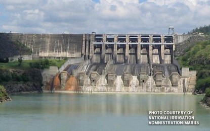
(PNA file photo of Magat Dam)
MANILA – A considerable volume of water continues to flow into Magat Dam which some blame for Region II's record-breaking flooding in the aftermath of Typhoon Ulysses (international name Vamco) this month.
The 6 a.m. water level in Magat Dam on Tuesday was recorded at 192.23 meters -- just 0.5 meters or some two feet lower than what it was 24 hours earlier despite sustained round-the-clock spilling operation, according to data from the Philippine Atmospheric, Geophysical and Astronomical Services Administration (PAGASA).
"That indicates Magat still has considerable inflow," said PAGASA hydrologist Rosalie Pagulayan.
She said runoff from rain of "Ulysses" and other tropical cyclones since October this year has been flowing into and increasing water in Magat, so spilling operation continues to release excess water from the dam.
PAGASA said Magat spilling operation was in progress as of 6 a.m. Tuesday with one gate open at a height of two meters.
One Magat gate was also open at the same height 24 hours earlier, PAGASA data also showed.
Such shows the dam continued releasing the same volume of water, Pagulayan noted.
"The resulting dip in Magat's water level is unnoticeable from a distance," she said.
PAGASA data further showed Magat Dam's 6 a.m. water elevation on Tuesday was just 0.77 meters below its spilling or normal high water level.
To ensure Magat's structural integrity, Pagulayan said water there must not rise above such level.
She said the spilling operation enables Magat to keep its water at a level that would not endanger the dam's structure.
Release of excess water from Magat Dam, rain from "Ulysses" and runoff from Sierra Madre and Cordillera mountain ranges collectively caused water in Region II's Cagayan River to rise and flood surrounding areas.
Water level in Cagayan River's downstream portion even rose to 13.30 meters on the night of Nov. 13 -- surpassing the 11.00 meters critical level and the 12.70-meter-high 2010 record water elevation there, noted Cagayan River Basin Flood Forecasting and Warning Center chief Leo Buñag.
Cagayanos are reportedly considering to file a class suit against National Irrigation Administration (NIA), Magat Dam's owner and operator, for the record-breaking flooding.
Buñag, however, believes the flooding could have been worse without Magat Dam.
The dam helped limit rise of water in Cagayan River since this facility is not just for irrigation and power generation but for flood control as well, he said earlier.
He noted the dam stores and regulates release of its water from Magat River which flows into Cagayan River.
Water in Magat River will flow unabatedly into Cagayan River -- causing water there to rise even higher and flood surrounding areas even more -- if there's no dam, he continued.
NIA also cited Magat Dam's role in flood control.
"Compared to other river systems, it is only Magat River which can delay surge of floodwater through its Magat Dam," NIA said in its Nov. 15, 2020 press release.
"Magat Dam is a catch basin of 4,143 square kilometers of watershed and eight upstream rivers namely: Alimit, Lamut, Ibulao in Ifugao province and Abian, Matuno, Sta. Cruz, Marang, Sta. Fe river in Nueva Vizcaya. With Magat Reservoir and Magat Dam to regulate gush of water from these sources, flash flood and greater flooding at low-lying areas, which could have caused greater damage to life and property, is minimized if not prevented," it added. (PNA)
