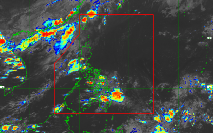
(Image grabbed from PAGASA's Facebook page)
MANILA – Weather disturbance "Dante" has further weakened into a tropical depression (TD), and reentered the Philippine Area of Responsibility (PAR) on Friday afternoon, a state forecaster said.
"Dante" was last tracked 210 km. west-northwest of Basco, Batanes or 185 km West of Itbayat, Batanes. It packs maximum sustained winds of 55 kph near the center and gustiness of up to 70 kph.
"Due to Dante's location, Tropical Cyclone Wind Signal no. 1 has been hoisted over Batanes," said Philippine Atmospheric, Geophysical and Astronomical Services Administration (PAGASA) weather specialist Raymond Ordinario.
Batanes will experience strong winds, and a gale warning is in effect over the northern seaboard of northern Luzon. Ordinario said those venturing out to the sea must take precautionary measures as sea travel is risky for small seacrafts over these waters.
"Dante" is expected to exit PAR by Saturday afternoon. It may also likely to downgrade into a low pressure area (LPA), according to Ordinario.
Meanwhile, Ordinario said Ilocos Region, Zambales, and Bataan may experience scattered rain showers due to "habagat" or the southwest monsoon.
Metro Manila and the rest of Luzon will have generally fair weather, but may also experience isolated rain showers caused by localized thunderstorms, he said.
PAGASA also forecast the same weather condition over the rest of the country. (PNA)
