(Courtesy of PAGASA)
MANILA – The Duterte government continues to keep close tabs on the movement of Tropical Storm (TS) Jolina, Malacañang assured the public on Tuesday.
In an online presser, Presidential Spokesperson Harry Roque said all frontline government agencies have already taken adequate preparations to provide assistance to people residing in areas that will be hit by TS Jolina.
“Handa po tayo. Nandiyan po ang lahat ng tulong, naka-preposition na (We are ready. The assistance is there and has already been preposition),” Roque said.
Roque said the Department of Social Welfare and Development (DSWD) has already preposition goods for families who will be affected by the storm.
He added that the government is ready to conduct preemptive evacuation and ensure the implementation of health protocols to prevent the spread of the coronavirus disease 2019 (Covid-19) in evacuation centers.
“Handa rin po ang ating health protocols sa mga center na iyan. Ang sinasabi ko po, sanay na po tayo sa mga paghamon dahil po sa bagyo at sa ulan (We are ready to implement health protocols in centers. What I’m saying is we’re ready to face the challenges brought about by typhoons and incessant rains),” Roque said.
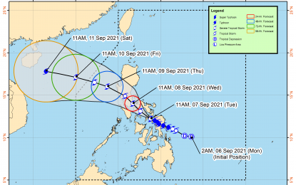
“Jolina” packs maximum sustained winds of 110 kilometers per hour (kph) near the center and gustiness of up to 135 kph, according to the 2 p.m. weather bulletin issued by the Philippine Atmospheric, Geophysical and Astronomical Services Administration (PAGASA).
The tropical storm continues to move west-northwestward over mainland Masbate.
Tropical Cyclone Wind Signal (TCWS) No. 2 has been hoisted over Masbate including Ticao and Burias Islands, the northern portion of Romblon, Sorsogon, Albay, the western and southern portions of Camarines Sur, the western portion of Camarines Norte, the central and southern portions of Quezon, Laguna, the southeastern portion of Batangas, Marinduque, the western portion of Northern Samar, the extreme northwestern portion of Samar, and the northern portion of Biliran.
TCWS No. 1 has been raised over the rest of Camarines Norte, the rest of Camarines Sur, the rest of Albay, Catanduanes, the rest of Romblon, Oriental Mindoro, Occidental Mindoro, the rest of Quezon, the rest of Batangas, Cavite, Metro Manila, Bulacan, Bataan, Nueva Ecija, Tarlac, Zambales, Pampanga, the southern portion of Aurora, the southern portion of Quirino, the southeastern portion of Nueva Vizcaya, the southern portion of Pangasinan, the rest of northern Samar, the northern and central portions of Samar, the northern of Eastern Samar, the rest of Biliran, the northern portion of Leyte, the northern portion of Cebu, the northern portion Negros Occidental, the northern portion of Iloilo, Capiz, and Aklan.
Heavy to intense with at times torrential rains are expected over Masbate, Leyte, Biliran, Samar, Northern Samar, Sorsogon, Albay, Catanduanes, Camarines provinces, Southern Quezon, Romblon, and Marinduque.
Mindoro provinces and the rest of Calabarzon and Visayas may also experience moderate to heavy with at times intense rains over.
Scattered to widespread flooding and rain-induced landslides are possible in areas that are highly or very highly susceptible to the hazard as identified in hazard maps. (PNA)
