(File photo)
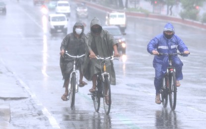
MANILA – Parts of the country will continue to experience heavy rains due to Severe Tropical Storm Maring (international name Kompasu) and the enhanced habagat or southwest monsoon, the weather bureau said Tuesday.
In its 5 a.m press briefing, the Philippine Atmospheric, Geophysical and Astronomical Services Administration (PAGASA) said as of 4 a.m., Maring was last observed 170 kilometers west of Calayan, Cagayan with winds of 100 kilometers per hour (kph) near the center and gusts of 125 kph.
Maring is moving west away from Northern Luzon at 20 kph and is expected to exit the Philippine Area of Responsibility Tuesday.
Weather forecaster Chris Perez said the southwest monsoon continues to affect the western section of Southern Luzon, the Visayas and Mindanao.
Tropical Cyclone Warning Signal No. 2 is hoisted in Batanes, Cagayan and Babuyan Island group, the northern portion of Isabela, Apayao, Kalinga, Mountain Province, Abra, Ilocos Norte and Ilocos Sur. These areas will experience damaging gale-to storm-force winds.
TCWS No. 1 is hoisted over the rest of Isabela, Nueva Vizcaya, Quirino, Ifugao, Benguet, La Union, Pangasinan, Aurora, Nueva Ecija, Tarlac, Zambales, Pampanga, Bulacan, the northern portion of Bataan, the northern portion of Quezon and Polilio islands. These areas will experience strong winds.
Moderate to heavy rainfall will prevail over Western Visayas, Occidental Mindoro, and Palawan in the next 24 hours.
Light to moderate, with at times heavy rain will also continue over the rest of the Visayas, Zamboanga Peninsula, and Oriental Mindoro.
Flash floods and rain-induced landslides are possible, especially in areas highly susceptible to these hazards.
Moderate to heavy, with at times intense rain is also expected over the rest of Cagayan. Light to moderate, with at times heavy rains are likely over the rest of Cagayan Valley and possibly over Central Luzon.
At 11 p.m. Monday, PAGASA Northern Luzon issued a red warning level over Benguet. Community preparedness is advised as serious flooding and landslides are possible in areas prone to these hazards.
Meanwhile, gusty conditions reaching strong to gale-force in strength may be experienced over the Visayas, Dinagat Islands, Surigao del Norte, Agusan del Norte, Misamis Oriental, Misamis Occidental, Camiguin, Zamboanga del Norte, and the rest of Luzon in the next 24 hours.
Rough to high seas will prevail over the seaboards of areas under TCWS no. 2 and 1.
Gale warning remains in effect over the western seaboard of Central Luzon where no TCWS has been hoisted, the seaboards of Southern Luzon and the Visayas, and the western, eastern, and northern seaboards of Mindanao.
Moderate to rough seas will prevail over the remaining seaboards of the country, PAGASA said. (PNA)
