MANILA – The trough of a low pressure area (LPA) will cause scattered rain showers and thunderstorms over Mindanao, the weather bureau said Friday.
"This LPA (was last tracked) around 900 kilometers east southeast of Mindanao. It has a slim chance to develop into a tropical cyclone, and also unlikely to enter the Philippine Area of Responsibility," Philippine Atmospheric, Geophysical and Astronomical Services Administration (PAGASA) forecaster Benison Estareja said.
The shear line affecting the eastern section of northern Luzon, on the other hand, will bring rains over Cagayan Valley and Aurora.
Residents of these areas are advised to take precautions against possible flash floods or landslides during moderate to heavy rains.
Meanwhile, Ilocos Region and Cordillera Administrative Region will have isolated light rains caused by the northeast monsoon.
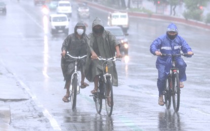
Metro Manila and the rest of the country will experience isolated rain showers due to localized thunderstorms.
Moderate to strong winds and moderate to rough seas will continue to prevail over northern and central Luzon, and the eastern section of southern Luzon, the Visayas, and Mindanao.
The northern and eastern seaboards of northern Luzon, the eastern seaboard of northern Luzon, the eastern seaboards southern Luzon, and the Visayas, and the eastern seaboard of Mindanao, will experience strong to gale force winds.
PAGASA advised fishing boats and other small sea vessels not to venture into the sea, and larger sea vessels are alerted against big waves.
Elsewhere, winds will be light to moderate with slight to moderate seas. (PNA)
