(PNby Robert Oswald P. Alfiler)
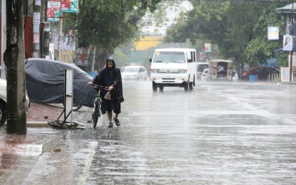
MANILA – La Niña phenomenon that will bring scattered rainfalls in several parts of the country is expected to last until the end of this year, an official of the Philippine Atmospheric, Geophysical and Astronomical Services Administration (PAGASA) said Thursday.
In an interview at the Laging Handa public briefing, PAGASA Administrator, Undersecretary Vicente Malano, said frequent rainfall will likely prevail in parts of Mindanao, Eastern Visayas, as well as Central and Eastern Luzon due to the La Niña episode.
In the last few days, Malano said the low pressure area (LPA) has brought rains in parts of the Zamboanga Peninsula and Northern Mindanao, especially in Cagayan de Oro City.
Scattered rain showers and thunderstorms are likewise expected to persist in parts of Eastern Visayas, Central Philippines, Bicol Region, Palawan, and Mindanao.
“Ito po ay sanhi po ng LPA na nakapaloob sa ITCZ (Intertropical Convergence Zone) at inaasahan po ito na patuloy po nating mararanasan habang nandito po iyong ating tinatawag na La Niña. Ang La Niña po ay inaasahan hanggang sa katapusan po nitong taon (This is because of the LPA inside the ITCZ and it is expected that we will continue to experience it in the presence of the so-called La Niña. And this La Niña phenomenon is expected until the end of this year),” Malano said.
Light to moderate rains will most likely prevail in Visayas, Bicol Region, Palawan, and other parts of Eastern Mindanao, he added.
“Ayon po sa ating mga datos na nakikita po sa ngayon ay wala po tayong nakikitang mga sama ng panahon o bagyo sa susunod na tatlong araw (Based on our data we don’t see a bad weather or storm instances so far, in the next three days),” Malano said.
However, Malano said the entry of a typhoon or tropical cyclone in the Philippine Area of Responsibility (PAR) is expected after three days.
“At ang characteristics po nitong dalawang bagyo na nakikita po natin ay kamukha po noong nakaraang dalawang bagyo na pumasok dito sa ating Philippine Area of Responsibility na itong sina Bagyong Caloy at Domeng kung saan na iyong si Bagyong Domeng ay papuntang norte at iyong isa (Bagyong Caloy) naman ay nanggagaling din po sa West Philippine Sea at pumunta po siya ng China area (And the characteristics of these two typhoons that we see are similar to the previous two typhoons that entered our Philippine Area of Responsibility, namely Typhoon Caloy and Domeng, where Typhoon Domeng is heading north and your other one came from the West Philippine Sea and went to the China area),” Malano said.
So far, four typhoons have entered the country’s PAR this year.
Malano said about 14 more typhoons will enter the PAR before the end of the year.
“So, inaasahan po natin na nasa labing-isa hanggang sa labing-apat na bagyo pa ang puwedeng pumasok sa ating (So we are expecting that about 11 to 14 typhoons will possibly enter the) Philippine Area of Responsibility. At ang karaniwang bagyo po na tumatama sa ating kalupaan ay (Most likely typhoons will hit in lands) towards the end of the year at malalakas po iyong bagyo na atin pong nararanasan (and we will experience stronger typhoons) during the last quarter of the year,” he added. (PNA)
