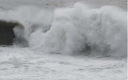
High waves are observed on the coast of Miyazaki Prefecture, southwestern Japan, on Saturday (Sept. 17, 2022) due to the approach of Typhoon Nanmadol. (Kyodo)
TOKYO – A large and powerful typhoon is forecast to approach Japan's Okinawa islands and the southwestern region of Kyushu this weekend, with the weather agency warning Saturday of violent winds, high waves, landslides, and flooding.
Typhoon Nanmadol has gained strength while moving slowly and is expected to pass very close to the Amami and Kyushu regions from Saturday night to Monday, according to the agency.
The Japan Meteorological Agency said the typhoon, which had an atmospheric pressure of 910 hectopascals at its center, could cause linear rainbands in the regions through Sunday before moving northeast and later possibly traveling across the country's main archipelago.
The typhoon, packing winds of up to 198 kilometers per hour (kph) with maximum gusts of 270 kph, is forecast to bring heavy rain to various parts of Japan during the three-day weekend through Monday.
The agency said southern Kyushu could receive up to 400 millimeters of rain in the 24 hours to 6 a.m. Sunday, while the Shikoku and Tokai regions in western and central Japan could see up to 300 mm of rainfall. (Kyodo)
