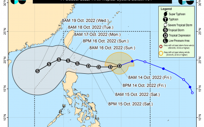
Track of Tropical Depression Neneng (Image courtesy of PAGASA)
MANILA – President Ferdinand "Bongbong" Marcos Jr. on Friday assured the public that he is closely monitoring the developments on Tropical Depression Neneng.
Marcos said the government is not letting its guard down, given that the weather disturbance is unpredictable.
He also advised the public to stay alert.
"The key to all of this is watch it very closely because may bagong feature ang mga bagyo ngayon (typhoons now have new features)," Marcos said in an interview on the sidelines of an event in Pasay City. "Mabilis mag develop so kailangan nakabantay tayo ng husto (It develops fast, that's why we have to closely monitor it). So, that’s what we are doing."
"It (Neneng) looks a little stronger than the previous one (Maymay)," Marcos said.
He said relief goods are already being prepositioned for families expected to be hit by the tropical depression.
Neneng has slightly weakened while it accelerates west-southwest, based on the 11 a.m. weather bulletin issued by the Philippine Atmospheric, Geophysical and Astronomical Services Administration (PAGASA).
Last located 835 km. east of extreme northern Luzon, Neneng is forecast to continue moving west-southwest before turning westward by Friday night or early Saturday morning.
PAGASA said Tropical Cyclone Wind Signal No. 1 may be hoisted on Friday afternoon over the eastern portion of northern Luzon in anticipation of winds of at least strong breeze to near-gale strength associated with the approaching tropical cyclone.
“Per latest track and intensity forecast, the most likely highest wind signal that will be hoisted is Wind Signal No. 2,” the weather bureau said.
Neneng is forecast to maintain this heading until it makes landfall or may pass very close to the Babuyan Islands or Batanes on Sunday, PAGASA said.
It may further intensify while moving over the Philippine Sea and may reach tropical storm category by Saturday evening or Sunday early morning.
According to the latest weather bulletin, Batanes, Cagayan, including Babuyan Islands, Apayao, and Kalinga will likely experience light to moderate with at times heavy rains on Saturday.
Moderate to heavy with at times intense rains may prevail in Batanes, Babuyan Islands, Cagayan, Apayao, Ilocos Norte, and Ilocos Sur. Light to moderate with at times heavy rains over the rest of the Ilocos and Cordillera regions on Sunday.
Under these conditions, flooding, including flash floods, as well as rain-induced landslides, are possible, especially in areas that are highly or very highly susceptible to these hazards as identified in hazard maps, PAGASA warned.
Neneng will move generally west-northwest and may exit the Philippine Area of Responsibility on Monday.
Maymay-affected families hit 6.3K
Meanwhile, the National Disaster Risk Reduction and Management Council (NDRRMC) on Friday said 6,323 families or around 22,681 persons residing in three regions were affected by Tropical Depression Maymay which dumped rains in some parts of Luzon before weakening into a low pressure area.
These families are residing in 133 barangays located in Cagayan Valley, Calabarzon and the Cordillera Administrative Region (CAR).
Some 150 families or 414 individuals are currently staying in 17 evacuation centers while the rest have either returned to their homes or stayed with relatives and friends.
One person was confirmed dead due to Maymay in Cagayan Valley.
Still undergoing validation is a report of another fatality, also in Cagayan Valley. (with report from Priam Nepomuceno/PNA)
