(Satellite image courtesy of PAGASA)
MANILA – Severe Tropical Storm Paeng maintained its strength as it made its fourth landfall in Santa Cruz town in the province of Marinduque at about 8:40 a.m. Saturday.
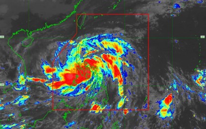
In its 11 a.m. weather bulletin, the Philippine Atmospheric, Geophysical and Astronomical Services Administration (PAGASA) said Paeng was last tracked in the vicinity of Mogpog, Marinduque, and is packing maximum sustained winds of 95 kph near the center and gustiness of up to 130 kph.
Paeng made landfall in Virac, Catanduanes at 1:10 a.m. on Saturday; Caramoan, Camarines Sur at 1:40 a.m.; and Buenavista, Quezon at 6 a.m.
Moving west-southwest at 25 kph, Paeng is expected to make landfall in the vicinity of the southeastern part of Batangas before crossing the Cavite-Metro Manila-Bataan Peninsula on Saturday afternoon.
PAGASA said heavy to intense with at times torrential rains are likely over Metro Manila, Calabarzon, Bicol region, Marinduque, Romblon, Mindoro provinces, and the northern portion of Palawan including Calamian and Cuyo Islands.
Moderate to heavy with at times intense rains are likely over mainland Cagayan Valley, the Cordillera region, Western Visayas, and Central Luzon.
Light to moderate with at times heavy rains are possible over the rest of Luzon and Visayas.
Tropical Cyclone Wind Signal (TCWS) No. 3 is now hoisted over Marinduque, the northern and central portions of Quezon (Pitogo, San Andres, Buenavista, Lucena City, San Francisco, Pagbilao, Infanta, Tiaong, Lopez, Catanauan, Mulanay, Unisan, General Luna, Plaridel, Quezon, San Antonio, Alabat, Candelaria, Lucban, Sampaloc, Padre Burgos, Sariaya, City of Tayabas, Macalelon, Mauban, Dolores, General Nakar, Perez, Agdangan, Gumaca, Atimonan, Real, San Narciso, Guinayangan, Calauag) including Pollilo Islands, Laguna, Batangas, Cavite, Metro Manila, Rizal, Bataan, the southern portion of Zambales (Olongapo City, Subic, Castillejos, San Antonio), and Lubang Islands.
TCWS No. 2 is raised over the northwestern portion of Sorsogon (Pilar, Donsol), the western portion of Masbate (Aroroy, Baleno, Mandaon) including Burias Island, Camarines Sur, Camarines Norte, Oriental Mindoro, Occidental Mindoro, the rest of Quezon, Romblon, Nueva Ecija, Pangasinan, Albay, the southern portion of Aurora (San Luis, Baler, Dingalan, Maria Aurora), Bulacan, Pampanga, Tarlac, and the rest of Zambales.
Also under TCWS No. 2 are the northwestern portion of Antique (Libertad, Pandan, Caluya Islands) and the western portion of Aklan (Buruanga, Malay, Nabas, Ibajay, Tangalan, Makato, Numancia, Lezo).
TCWS No. 1 is hoisted over the provinces of Isabela, Nueva Vizcaya, Quirino, Abra, Kalinga, Ifugao, Mountain Province, Benguet, Ilocos Sur, La Union, the rest of Aurora, Catanduanes, the rest of Sorsogon, the rest of Masbate including Ticao Island, and the northern portion of Palawan (El Nido, Taytay, Dumaran, Araceli, Roxas, San Vicente) including Calamian and Cuyo Islands.
The provinces of Northern Samar, Samar, Eastern Samar, Biliran, Leyte, Southern Leyte, Cebu including Bantayan and Camotes Islands, Bohol, Negros Occidental, Negros Oriental, Guimaras, the rest of Aklan, the rest of Antique, Capiz, and Iloilo are also under TCWS No. 2.
On Sunday, moderate to heavy with at times intense are likely over Zambales, Bataan, and Ilocos region.
Light to moderate with at times heavy rains are possible over Metro Manila, Mimaropa, the rest of Calabarzon, and the rest of Central Luzon. (PNA)
