(File photo)
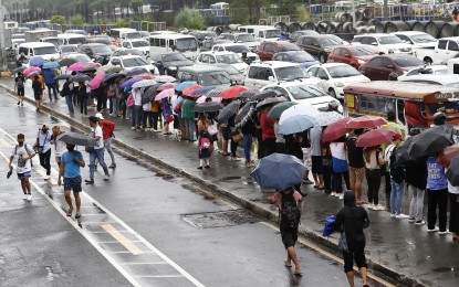
MANILA – Most areas in the country will continue to experience rains caused by the trough of a low pressure area (LPA) and the northeast monsoon (amihan), the weather bureau said Thursday.
The LPA last tracked 750 kilometers east of Hinatuan, Surigao del Sur is less likely to develop into a tropical cyclone.
However, its trough will bring scattered rain showers and thunderstorms over Caraga, Davao Region, Northern Mindanao and Zamboanga Peninsula.
Flash floods or landslides are possible in these areas due to moderate to heavy rains.
Isolated rain showers caused by localized thunderstorms are also forecast over the rest of Mindanao, the Philippine Atmospheric, Geophysical and Astronomical Services Administration (PAGASA) said, adding that flash floods or landslides are possible during severe thunderstorms.
Rains caused by the northeast monsoon will prevail over Cagayan Valley, Cordillera Administrative Region, Bicol Region, Aurora, Quezon and Oriental Mindoro. These areas may experience flash floods or landslides due to moderate to heavy rains.
The rest of the country will experience light rains due to the northeast monsoon but with no significant impact, according to PAGASA.
Moderate to strong winds and moderate to rough seas will prevail over Luzon and the Visayas.
Rough to very rough seas are forecast over the western seaboard of Northern Luzon, the northern, eastern, western and southern seaboards of Luzon, the eastern and western seaboards of the Visayas, and the eastern seaboard of Mindanao.
PAGASA advised fishing boats and other small seacraft not to venture into the sea, and larger sea vessels are alerted against big waves.
Over Mindanao, winds will be light to moderate with slight to moderate seas, PAGASA said. (PNA)
