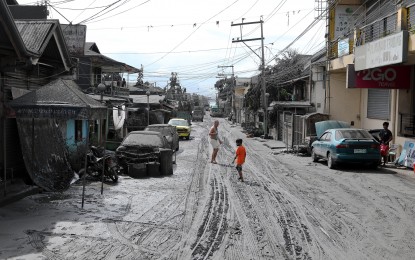
ASHFALL EVERYWHERE. Photo shows P. Burgos St. in Tanauan City, Batangas, covered with ashes due to the continuous spewing of ashes from Taal Volcano over the weekend. Alert Level 4 is still up over Taal Volcano. (PNA photo by Joey Razon)
MANILA -- Weaker eruption has been observed in Taal Volcano, but it is still under Alert Level 4 (hazardous explosive eruption is possible within hours to days), the Philippine Institute of Volcanology and Seismology (Phivolcs) announced in its bulletin on Wednesday.
"The common misconception is that people look at what's going out (of the crater). Maybe you don't see the smoke now, but that doesn't mean there's no activity (below)," Phivolcs director Renato Solidum explained to the Philippine News Agency (PNA), as to why the volcano remains on Alert Level 4 status despite the reported weaker eruption.
The weaker eruption, he said, was based on the height of the plume coming out of the crater. Volcanic plume or eruption plume is a column of hot volcanic ash and gas emitted into the atmosphere during an explosive volcanic eruption.
"From 5 a.m. Tuesday until 5 a.m. today, the height of the plume is just one kilometer, compared to its height of 10-15 kilometers last Sunday (when the volcano erupted)," he said.
The alert level, he explained, forecasts the condition of the volcano.
There were still many earthquakes, and fissures have been observed. That's why the volcano remains on Alert Level 4, he explained.
"What the people see on the surface, and what's happening below, may be different," Solidum noted, reiterating that the weaker eruption should not be perceived as the volcano being on a lower alert status.
Phivolcs recorded 159 volcanic earthquakes, of which 28 were felt with intensities 2 to 3, from 5 a.m. of January 14 until January 15, 5 a.m.
This intense seismic activity probably signifies continuous magmatic intrusion beneath Taal edifice, which may lead to further eruptive activity, according to Phivolcs.
"The magma intrusion from below causes the fissures to form," Solidum said.
A fissure is a linear volcanic vent through which lava erupts, usually without any explosive activity. The vent is often a few meters wide and may be many kilometers long.
Fissures or cracks were observed in Sinisian, Mahabang Dahilig, Dayapan, Palanas, Sangalang, Poblacion, Mataas na Bayan, Lemery; Pansipit, Bilibinwang, Agoncillo; Poblacion 1, Poblacion 2, Poblacion 3, Poblacion 5, Talisay and Poblacion, San Nicolas. A fissure transected the road connecting Agoncillo to Laurel, Batangas.
Meanwhile, Solidum reiterated that the Phivolcs strongly advises total evacuation of Taal Volcano Island and other high-risk areas within the 14-kilometer radius from Taal.
"We have added Pansipit River (Valley) among the areas that we recommend total evacuation. There's a fishing activity there, and it's very dangerous," he said, adding that fissures were also observed along the area. (PNA)
