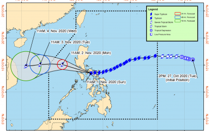
MANILA – The Philippine Atmospheric, Geophysical and Astronomical Services Administration (PAGASA) reported that Typhoon Rolly (international name: Goni) further weakened as it made its third landfall in San Narcisco, Quezon at 12 p.m. on Sunday.
In its 2 p.m. weather bulletin, the weather bureau said it is now over Mongpong Pass and violent winds and intense rainfall associated with the region of the eyewall and inner rainbands of the typhoon is prevailing or expected within the next 12 hours over the Marinduque, Laguna, the eastern portion of Batangas, and Cavite.
"The center of this typhoon will continue to move over the Marinduque-central Quezon this afternoon and towards Batangas-Cavite area late afternoon through evening. Between 4 to 7 p.m., the center of the eye of ‘Rolly’ is located around 70 km south of Metro Manila," it added.
“Rolly” made its first landfall over Bato, Catanduanes at 4:50 a.m. and followed by another landfall in the vicinity of Tiwi, Albay at 7:20 a.m. on Sunday.
PAGASA earlier downgraded “Rolly” from super typhoon to typhoon which is forecast to exit the mainland Luzon landmass and emerge over the West Philippine Sea on Sunday night.
It warned the public against heavy to intense rains over Calabarzon, Metro Manila, Marinduque, Romblon, Mindoro provinces, Bataan, Bulacan, Aurora, and the eastern portions of mainland Cagayan and Isabela.
Meanwhile, moderate to heavy rains will be experienced over Cordillera Administrative Region, and the rest of mainland Cagayan Valley and Central Luzon. Light to moderate with at times heavy rains will be experienced over Zamboanga Peninsula, Bangsamoro, Western Visayas and the rest of Luzon.
PAGASA also warned the public against flash floods, rain-induced landslides, and sediment-laden streamflows like lahar which may occur during heavy or prolonged rainfall especially in areas that are highly or very highly susceptible to these hazards.
It added very destructive to devastating typhoon-force winds will be experienced in areas under Tropical Cyclone Wind Signals (TCWS) No. 4, destructive typhoon-force winds in areas under TCWS No. 3, damaging gale- to storm-force winds in areas under TCWS No. 2, and strong breeze to near gale conditions in areas under TCWS No. 1.
TCWS elsewhere has been lowered or lifted.
TCWS No. 4 is hoisted in:
-- Camarines Norte
-- the northwestern portion of Camarines Sur (Sipocot, Lupi, Ragay, Del Gallego)
-- Marinduque
-- Metro Manila
-- Cavite
-- Laguna
-- Batangas
-- Rizal
-- Quezon including Polillo Islands
-- Pampanga
-- Bulacan
-- the southern portion of Aurora (Dingalan)
-- Bataan
-- the southern portion of Zambales (San Marcelino)
-- San Felipe
-- San Narciso
-- San Antonio
-- Castillejos
-- Subic
-- Olongapo City
-- Botolan
-- Cabangan
-- the northwestern portion of Occidental Mindoro (Mamburao, Paluan) including Lubang Island
-- the northern portion of Oriental Mindoro (Victoria, Naujan Lake, Pola, Naujan, Calapan City, Baco, San Teodoro, Puerto Galera)
Areas under TCWS No. 3 are:
-- the rest of Camarines Sur,
-- the rest of Zambales
-- Tarlac
-- the southern portion of Nueva Ecija (Cuyapo, Talugtug, Muñoz City, Llanera, Rizal, Bongabon, Gabaldon, General Tinio, Laur, Palayan City, General Mamerto Natividad, Cabanatuan City, Santa Rosa, Peñaranda, Gapan City, San Isidro, Cabiao, San Antonio, Jaen, San Leonardo, Zaragoza, Aliaga, Talavera, Santo Domingo, Quezon, Licab, Guimba, Nampicuan)
-- the central portion of Aurora (San Luis, Baler, Maria Aurora)
-- the northern portion of Occidental Mindoro (Santa Cruz, Sablayan)
-- Burias Island
-- the northern portion of Oriental Mindoro (Socorro, Pinamalayan, Gloria, Bansud, Bongabong, Roxas)
-- Romblon
TCWS No. 2 is hoisted in:
-- the rest of Aurora
-- Nueva Vizcaya
-- Quirino
-- Benguet
-- La Union
-- Pangasinan
-- the rest of Nueva Ecija
-- Catanduanes
-- Albay
-- Sorsogon
-- the northern portion of Masbate (Aroroy, Mandaon, Balud, Baleno, Milagros, Masbate City, Mobo, Uson, Cawayan, Dimasalang) including Ticao Island
-- the rest of Occidental Mindoro, and the rest of Oriental Mindoro
Areas under TCWS No. 1
-- Mainland Cagayan
-- Isabela
-- Apayao
-- Kalinga
-- Mountain Province
-- Ifugao
-- Abra
-- Ilocos Norte
-- Ilocos Sur
-- the rest of Masbate
-- the northern portion of Palawan (El Nido, Taytay, Dumaran, Araceli) including Calamian and Cuyo Islands
-- the northern portion of Antique (Sebaste, Culasi, Tibiao, Barbaza, Laua-An, Pandan, Libertad, Caluya)
-- Aklan
-- Capiz
-- the northern portion of Iloilo (Lemery, Sara, Concepcion, San Dionisio, Batad, Estancia, Balasan, Carles)
-- the northwestern portion of Northern Samar (Allen, Victoria, Lavezares, Rosario, San Jose, Biri, San Isidro, San Antonio, Capul, San Vicente)
As 1 p.m. Sunday, the center of the eye of Typhoon Rolly was located based on all available data at over the coastal waters of Mulanay, Quezon with maximum sustained winds of 175 km/h near the center and gustiness of up to 240 km/h.
"The public and the disaster risk reduction and management council concerned are advised to take appropriate actions and watch for the next Severe Weather Bulletin to be issued at 5 p.m. today," PAGASA said. (PNA)
