(File photo)
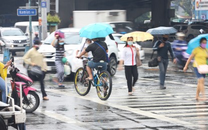
MANILA – Most parts of the archipelago will continue to experience rains due to the trough of a low-pressure area (LPA), the shear line affecting the eastern section of southern Luzon, and the Visayas, as well as the northeast monsoon affecting northern and central Luzon.
In its 4 a.m. bulletin on Thursday, the Philippine Atmospheric, Geophysical and Astronomical Services Administration (PAGASA) forecast scattered rain showers and thunderstorms to prevail over the Bicol, Eastern Visayas, Caraga, and Davao regions.
Flash floods or landslides are likely in these areas during moderate to heavy rains.
The bureau said even if the shear line has weakened, it may still cause light to moderate rains over Bicol and Eastern Visayas.
Meanwhile, the northeast monsoon or “amihan” will bring light rains over Cagayan Valley, Apayao, and Aurora; and isolated light rains over the Ilocos Region, the rest of the Cordillera region, and the rest of central Luzon.
Metro Manila and the rest of the country may have isolated rain showers due to localized thunderstorms.
Moderate to strong winds and moderate to rough seas will continue to prevail over northern and central Luzon, and the eastern section of southern Luzon, the Visayas, and Mindanao.
Strong to gale-force winds are forecast over the northern and eastern seaboards of northern Luzon; eastern seaboards of central Luzon, southern Luzon, the Visayas, and Mindanao; and the western seaboard of northern Luzon.
PAGASA advised fishing boats and other small vessels not to venture into the sea, while larger sea vessels are alerted against big waves.
Elsewhere, winds will be light to moderate with slight to moderate seas. (PNA)
