(PNA photo by Avito C. Dalan)
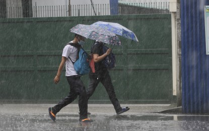
MANILA – The monsoon trough and the southwest monsoon (habagat) enhanced by Tropical Depression (TD) Caloy will bring rains over the western section of Luzon and the Visayas, the weather bureau said Wednesday.
Monsoon rains may be experienced over Bataan, Zambales, Palawan, Oriental Mindoro, Occidental Mindoro, Aurora, and Quezon, the Philippine Atmospheric, Geophysical and Astronomical Services Administration (PAGASA) said.
Flash floods or landslides are likely due to scattered to widespread moderate to at times heavy rains.
The rest of Luzon, the Visayas, and Zamboanga Peninsula will experience scattered rain showers and thunderstorms.
Isolated rain showers were forecast but flash floods or landslides are possible during severe thunderstorms for the rest of Mindanao.
The enhanced habagat will also bring occasionally gusty conditions, reaching a strong breeze to near-gale in strength over extreme northern Luzon, and the western section of Luzon and the Visayas.
These conditions are more likely in coastal and mountainous or upland localities of these areas, PAGASA said.
Further, the enhanced habagat will cause moderate to rough seas over the seaboards of northern Luzon, and the western seaboards of central and southern Luzon.
The bureau said these conditions may be risky for those using small sea vessels.
Mariners are advised to take precautionary measures when venturing to the sea. If possible, avoid navigating in these conditions.
In its weather bulletin issued at 4 a.m., PAGASA said “Caloy” was last tracked at 395 km. west of Iba, Zambales, slowly moving west and packing maximum sustained winds of 45 kph near the center and gusts of up to 55 kph.
The TD is forecast to exit the Philippine Area of Responsibility within 24 hours. (PNA)
