photo:
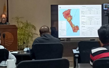
SINKHOLES. Engr. Mae Magarzo, chief of the MGB Geosciences Division, presents the result of their Karst Subsidence Hazard Mapping of Boracay in a media forum on Monday (Dec. 12, 2022). She said the carrying capacity of Boracay must be observed as the island is vulnerable to sinkholes. (PNA photo by PGLena)
ILOILO CITY – The Mines and Geosciences Bureau of the Department of Environment and Natural Resources (MGB-DENR) said the carrying capacity of Boracay island must be observed, as it is vulnerable to sinkholes.
“Sinkholes are land depressions due to the removal of support underneath due to earthquake, or due to the lowering of the ground waters. These sinkholes are not found in other types of rocks but exclusively in limestone areas,” said Mae Magarzo, chief of the MGB Geosciences Division during a media forum on Monday.
Boracay Island, one of the world's top island destinations, is entirely limestone. Its chemical composition, which is calcium carbonate, gradually melts when it comes in contact with acid, especially acid rain. And sinkholes are formed in limestone, she said.
The Karst Subsidence Hazard Mapping conducted in 2018 has identified 789 sinkholes, 801 in 2019, 814 in 2020, and 815 from 2021-2022.
These sinkholes are scattered in all three barangays in Boracay.
Magarzo said a sinkhole is the most dangerous type of hazard because it has no indication of when it will appear. Once there is no support underneath, it will just collapse along with any structures standing in the affected area, she added.
“That is why we want carrying capacity be observed because as you could see in our geo-hazard map in Karst Subsidence, almost all are highly susceptible,” Magarzo said.
She said the agency has recommended lessening the weight of the structures that stand on the limestone, especially for one-story building.
A study conducted by the DENR –Ecosystems Research and Development Bureau in 2018 showed that in terms of tourism, the carrying capacity of the island stands at 19,215 at any given time, or equivalent to 6,405 arrivals a day for a three-day stay.
The study showed that an ideal arrival per day should be 6,085.
The number of physical carrying capacity or the maximum number of structures has also exceeded. Although the agency has not provided the exact numbers.
In terms of the population carrying capacity, the number of persons has exceeded by 15,836 a day since the total population carrying capacity of the island was only 54,945 when the study was conducted.
Cyndy Sol Rodrigo of the DENR 6 -Conservation and Development Division (CDD), in her presentation, added that the island also exceeded the solid waste capacity, water supply, water use, and wastewater generation.
DENR regional executive director Livino Duran said the agency will release an updated carrying capacity study next year. (PNA)
