(PNA photo by Robert Alfiler)
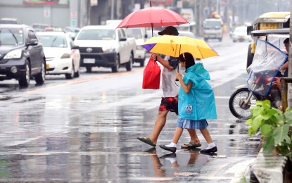
MANILA – The southwest monsoon (habagat) enhanced by Typhoon Chedeng will cause occasional rains over some portions of southwestern Luzon and gusty conditions in some parts of the country in the next three days, the weather bureau said Friday.
Chedeng, last tracked 875 km. east of Central Luzon or 910 km. east of Northern Luzon, is unlikely to directly bring heavy rainfall as it remains far from the landmass, according to the 4 a.m. weather bulletin of the Philippine Atmospheric, Geophysical and Astronomical Services Administration (PAGASA).
However, the enhanced "habagat" may bring scattered light to moderate rain showers and thunderstorms over Palawan on Friday.
It will also cause gusty conditions over the Visayas, Romblon, Occidental Mindoro, the northern portion of Palawan including Kalayaan, Calamian, and Cuyo Islands, Surigao del Norte, Dinagat Islands, and Camiguin.
Chedeng packs maximum sustained winds of 130 kph near the center and gustiness of up to 160 kph.
The hoisting of tropical cyclone wind signals remains unlikely, but the typhoon may cause moderate to rough seas over the seaboards of extreme Northern Luzon and the eastern seaboard of mainland Northern Luzon.
PAGASA advised mariners of small vessels to take precautionary measures when venturing into the sea.
"If inexperienced or operating ill-equipped vessels, avoid navigating in these conditions," it added. (PNA)
