(PNA photo by Joan Bondoc)
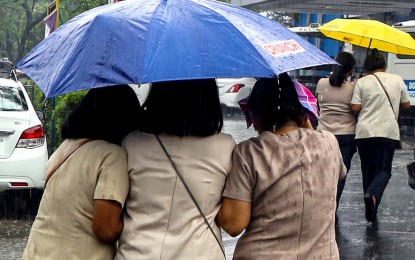
MANILA – Typhoon Egay and the enhanced southwest monsoon (habagat) will cause strong winds and gusty conditions over most of Luzon, the Visayas and some areas in Mindanao, the weather bureau said Monday.
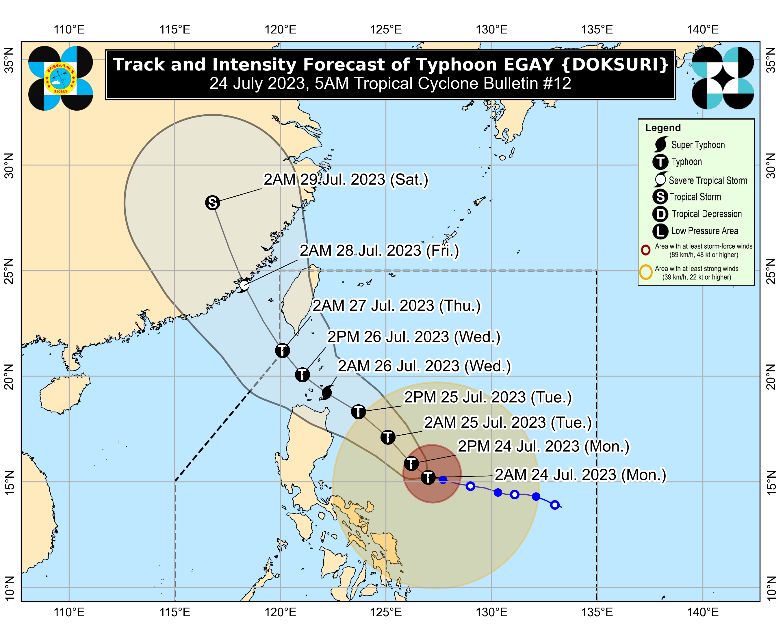
In its 5 a.m. bulletin, the Philippine Atmospheric, Geophysical and Astronomical Services Administration (PAGASA) said Egay was packing maximum sustained winds of 140 kilometers per hour near the center and gustiness of up to 170 kph.
The typhoon was last located 565 kilometers east of Baler, Aurora, and moving westward at 15 kph.
Minor to moderate impacts from gale-force winds are possible in these areas where tropical cyclone wind signal (TCWS) No. 2 is in effect: southeastern portion of Isabela (Palanan, Dinapigue) and northeastern portion of Catanduanes (Pandan, Bagamanoc, Panganiban, Viga, Gigmoto).
Minimal to minor impacts from strong winds are possible in areas where TCWS No. 1 has been hoisted: Batanes, Cagayan including Babuyan Islands, the rest of Isabela, Quirino, Nueva Vizcaya, Apayao, Kalinga, Abra, Mountain Province, Ifugao, Benguet, Ilocos Norte, Ilocos Sur, La Union, the northern portion of Pangasinan (Natividad, San Nicolas, San Quintin, Sison, Pozorrubio, San Manuel, San Fabian, Anda, Bolinao, San Jacinto, Manaoag, Laoac, Binalonan, Asingan, Tayug, Santa Maria, Umingan, Dagupan City, Mangaldan), Aurora, the northern and eastern portions of Nueva Ecija (Carranglan, Bongabon, Gabaldon, Pantabangan, Lupao, San Jose City), the northern and southeastern portions of Quezon (Pitogo, San Andres, Buenavista, San Francisco, Calauag, Infanta, Lopez, Catanauan, Mulanay, Guinayangan, Unisan, General Luna, Plaridel, Quezon, Alabat, Padre Burgos, Macalelon, Mauban, General Nakar, Perez, Agdangan, Gumaca, Atimonan, Real, San Narciso, Tagkawayan) including Polillo Islands, Camarines Norte, Camarines Sur, the rest of Catanduanes, Albay, Sorsogon, and Masbate.
PAGASA said gusty conditions due to Egay and the "habagat" may be experienced in Region 4-A (Calabarzon), Region 4-B (Mimaropa), the Visayas, and the northern portions of Zamboanga Peninsula, Northern Mindanao, and Caraga.
Both Egay and the "habagat" are also forecast to cause occasional monsoon rains over the western portions of Central Luzon, Southern Luzon, and the Visayas in the next three days.
Canceled flights
As of 7:50 a.m., the Manila International Airport Authority reported cancelations of only two flights due to inclement weather: Cebu Pacific flights 5J 821/822 between Manila and Virac.
Meanwhile, PAGASA said sea travel is risky for small sea vessels on the coastal waters along the northern and eastern seaboards of Northern Luzon, the eastern seaboard of Central Luzon, the seaboards of Southeastern Luzon, and the eastern seaboards of the Visayas and Northeastern Mindanao.
Egay is forecast to make landfall or pass very close to the Babuyan Islands-Batanes area between Tuesday night and Wednesday afternoon.
The typhoon is expected to exit the Philippine Area of Responsibility on Thursday. (PNA)
