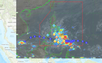
Track of Tropical Storm Kabayan (Image from PAGASA)
MANILA – Tropical Storm (TS) Kabayan is forecast to make landfall along the coast of Davao Oriental or southern Surigao del Sur on Monday, with several areas now under Signal No. 2, the Philippine Atmospheric, Geophysical and Astronomical Services Administration (PAGASA) said.
Kabayan, which was last tracked over the coastal waters of Caraga, Davao Oriental, could also make another landfall over central or southern Palawan on Tuesday, and emerge over the West Philippine Sea.
Kabayan packs maximum sustained winds of 65 kilometers per hour near the center and gustiness of up to 80 kph.
Tropical cyclone wind signal (TCWS) No. 2 has been hoisted over Dinagat Islands, Surigao del Norte including Siargao and Bucas Grande Islands, Surigao del Sur, the northern portion of Agusan del Norte (Kitcharao, Jabonga, Santiago, City of Cabadbaran, Remedios T. Romualdez, Tubay), the eastern portion of Agusan del Sur (Trento, Bunawan, San Francisco, Rosario, Prosperidad, City of Bayugan, Sibagat), and the northern portion of Davao Oriental (Boston, Cateel). Gale-force winds will prevail in those areas.
TCWS No. 1, on the other hand, has been hoisted over the southern portion of mainland Palawan (Sofronio Española, Brooke's Point, Bataraza, Balabac, Rizal, Quezon, Narra) and Cagayancillo Islands, Southern Leyte, Leyte, the southern portion of Samar (Basey, Santa Rita, Marabut, Talalora, Villareal, Pinabacdao), the southern portion of Eastern Samar (Maydolong, City of Borongan, Quinapondan, Guiuan, Lawaan, Balangiga, Llorente, Giporlos, Salcedo, Balangkayan, General Macarthur, Hernani, Mercedes), Cebu including Camotes and Bantayan Islands, Bohol, Siquijor, Negros Oriental, Negros Occidental, and Guimaras.
Also under TCWS No. 1 are the rest of Agusan del Norte, the rest of Agusan del Sur, the central portion of Davao Oriental (Baganga, Manay, Caraga, Tarragona, Lupon, Banaybanay), Davao de Oro, Davao del Norte, Davao City, Camiguin, Misamis Oriental, Bukidnon, Misamis Occidental, Lanao del Norte, Lanao del Sur, the northern portion of Maguindanao del Norte (Buldon, Barira, Matanog, Parang, Sultan Kudarat, Sultan Mastura), the northern portion of Cotabato (Arakan, Carmen, Banisilan, Alamada, President Roxas, Kabacan, Matalam, Antipas, Magpet, Libungan, Pigkawayan), the northern and central portions of Zamboanga del Norte (Siayan, Sindangan, Jose Dalman, Manukan, Pres. Manuel A. Roxas, Sergio Osmeña Sr., Katipunan, Dipolog City, Polanco, Mutia, Piñan, Dapitan City, Sibutad, La Libertad, Rizal, Siocon, Baliguian, Gutalac, Labason, Kalawit, Tampilisan, Liloy, Salug, Godod, Bacungan), Zamboanga del Sur, Zamboanga Sibugay.
Areas under Signal No. 1 will experience strong winds, PAGASA said.
It added that Kabayan could affect the shear line, which could result in heavy rainfall over the eastern portion of Southern Luzon.
Forecast rainfall is generally higher in elevated or mountainous areas. Flooding and rain-induced landslides are likely, especially in areas highly susceptible to these hazards, according to the weather bureau.
Meanwhile, rough to very rough seas are forecast along the coastal waters along the seaboard of Northern Luzon, the eastern and central seaboards of the Visayas, and the eastern seaboards of Central and Southern Luzon, and Mindanao.
Sea travel is risky for small sea vessels and mariners of these vessels are advised to remain in port or seek safe harbor. (PNA)
