MANILA -- The Philippine Atmospheric, Geophysical and Astronomical Services Administration (PAGASA) has spotted two low-pressure areas (LPAs) in the vicinities of Visayas and Mindanao, bringing more rains in the country on Friday.
In a 4 p.m. weather forecast, PAGASA weather specialist Meno Mendoza said the intertropical convergence zone (ITCZ) will bring rains over eastern Visayas and Mindanao and has two low-pressure areas (LPAs) in the area.
The ITCZ is an area where the northern and southern air masses converge and is a known breeding ground for typhoons.
One of the LPAs was spotted 115 kilometers south-southwest of Puerto Princesa City, Palawan, while the other was located 980 kilometers east-southeast of Hinatuan, Surigao del Sur.
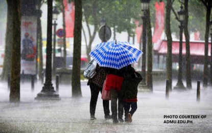
PAGASA sees eastern Visayas and Mindanao to experience cloudy skies with scattered rain showers and thunderstorms.
The state-run weather bureau further warned of possible floodings or landslides due to light to moderate rains in these areas.
Mendoza added the easterlies will bring warm weather in other parts of the country on Friday.
However, partly cloudy to cloudy skies with isolated rain showers are also expected due to local thunderstorms.
Palawan will have moderate to rough coastal waters, caused by moderate to strong winds coming from the east to northeast, while northern Luzon will have light to moderate coastal waters due to light to moderate winds coming from the east to southeast.
Other areas will have slight to moderate coastal waters brought by light to moderate winds from the east to northeast.
The country will have a temperature range of 17-39 degrees Celsius until Monday.
On Thursday, PAGASA recorded a peak temperature of 35.7 degrees Celsius and a minimum temperature of 26.2 degrees Celsius at the PAGASA weather station in Quezon City. (PNA)
