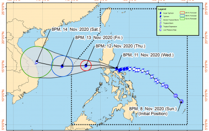
(Image grabbed from PAGASA's Facebook page)
MANILA – The center of Typhoon Ulysses' eye made a landfall in the vicinity of Patnanungan, Quezon on Wednesday night, the weather bureau said.
In its 11p.m. bulletin, the Philippine Atmospheric, Geophysical and Astronomical Services Administration (PAGASA) said "Ulysses" further intensified, packing a maximum sustained winds of 150 kph near the center, and gustiness of up to 205 kph.
It added that destructive typhoon force winds will continue to prevail in areas under tropical cyclone wind signal (TCWS) no. 3 that includes the southern portion of Quirino (Maddela, Nagtipunan), the southern portion of Nueva Vizcaya (Alfonso Castaneda, Dupax Del Norte, Dupax Del Sur), Pangasinan, Nueva Ecija, Aurora, Tarlac, Zambales, Bataan, Pampanga, Bulacan, Metro Manila, Rizal, Cavite, Laguna, Batangas, the northern and central portions of Quezon (General Nakar, Infanta, Real, Mauban, Sampaloc, Lucban, Tayabas City, Sariaya, Candelaria, Dolores, Tiaong, San Antonio, Lucena City, Pagbilao, Atimonan, Padre Burgos, Unisan, Agdangan, Gumaca, Plaridel, Pitogo, Macalelon, Lopez, General Luna, Catanauan, Buenavista, Guinayangan, Tagkawayan, Calauag, Quezon, Alabat, Perez) including Polillo Islands, Camarines Norte, and the northern portion of Camarines Sur (Siruma, Cabusao, Libmanan, Sipocot, Lupi, Ragay, Del Gallego, Tinambac, Calabanga, Bombon, Magarao).
Damaging gale to storm force winds will be experienced in areas under TCWS no. 2, namely: central and southern portions of Isabela (Mallig, Quirino, Ilagan, Roxas, Burgos, Gamu, Palanan, San Mariano, Dinapigue, San Guillermo, Benito Soliven, Naguilian, Reina Mercedes, Luna, San Manuel, Aurora, Cabatuan, Cauayan City, San Mateo, Alicia, Angadanan, Echague, Jones, San Agustin, San Isidro, Ramon, Santiago City, Cordon); the rest of Quirino; the rest of Nueva Vizcaya, Mountain Province, Ifugao, Benguet; the southern portion of Ilocos Sur (Cervantes, Quirino, San Emilio, Lidlidda, Santiago, Banayoyo, Candon City, Galimuyod, Gregorio Del Pilar, Salcedo, Santa Lucia, Santa Cruz, Sigay, Suyo, Tagudin, Alilem, Sugpon), La Union; the northern portion of Occidental Mindoro (Paluan, Abra de Ilog) including Lubang Island; the northern portion of Oriental Mindoro (Pola, Victoria, Naujan, Baco, Calapan City, San Teodoro, Puerto Galera); Marinduque; the rest of Quezon; the rest of Camarines Sur, Catanduanes, Albay, Burias Island; and the northern portion of Sorsogon (Sorsogon City, Castilla, Pilar, Donsol).
TCWS no. 1 was hoisted over the rest of Isabela, Kalinga, Abra, the rest of Ilocos Sur, the rest of Occidental Mindoro, the rest of Oriental Mindoro, Romblon, the rest of Sorsogon, and the central and western portion of Masbate (Palanas, Cawayan, Milagros, Dimasalang, Uson, Mobo, Masbate City, Baleno, Aroroy, Mandaon, Balud) including Ticao Island, and the western portion of northern Samar (Lavezares, Biri, San Jose, Rosario, Victoria, San Isidro, Allen, San Antonio, Capul, San Vicente).
These areas will have strong breeze to near gale conditions.
Strong breeze to near gale conditions will also prevail over the rest of northern Luzon due to the surge of the northeast monsoon, PAGASA said.
Meanwhile, heavy to intense, with at times torrential rains will continue over Camarines Norte, Camarines Sur, Metro Manila, Calabarzon, central Luzon, Quirino, Nueva Vizcaya, and the eastern portion of Isabela.
Moderate to heavy, with at times intense rains, will be experienced over Cordillera Administrative Region, the rest of mainland Cagayan Valley, Pangasinan, Marinduque, the northern portion of Mindoro Provinces including Lubang Island, Albay, Catanduanes, and Burias Island.
Light to moderate, with at times heavy rains are expected over the rest of Luzon and Visayas.
Flooding, rain-induced landslides, and sediment-laden stream flows may occur during heavy or prolonged rainfall, according to PAGASA.
The seaboards of areas under TCWS and the northern seaboard of northern Samar will continue to have rough to very high seas.
Rough to high seas will also continue over the remaining seaboards of northern Luzon, and rough to very rough seas over the western seaboard of Palawan including Calamian and Kalayaan Islands.
Sea travel is risky for all types of vessels over these waters.
Moderate to rough seas will prevail over the eastern seaboards of Visayas and Mindanao, the seaboards of Cuyo Islands, and the western seaboard of Panay Island.
PAGASA advised mariners of small seacraft to take precautionary measures when venturing to the sea. (PNA)
