(File photo)
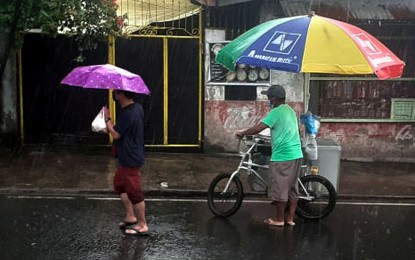
MANILA – Cloudy skies with scattered rain showers and thunderstorms will prevail over Metro Manila, parts of Luzon and the Visayas due to low pressure area (LPA), the Philippine Atmospheric, Geophysical and Astronomical Services Administration (PAGASA) said Sunday.
The agency said the LPA was estimated based on all available data in the vicinity of San Vicente, Palawan and embedded along the Intertropical Convergence Zone (ITCZ) affecting Southern Luzon, Visayas, and Mindanao at 3 a.m.
Cloudy skies with rains are expected over Batanes and Babuyan Islands due to northeasterly surface windflow.
The rest of the country will have partly cloudy to cloudy skies with isolated rain showers or thunderstorms due to ITCZ or localized thunderstorms.
Moderate to strong winds moving northeast with moderate to rough coastal waters will blow over Northern and Central Luzon.
Meanwhile, light to moderate winds from southwest to southeast will blow over Palawan, Visayas, and Mindanao with slight to moderate coastal waters.
The rest of Luzon will experience light to moderate winds moving east to northeast with slight to moderate coastal waters.
PAGASA said the LPA may develop into a tropical depression within 48 hours and it would be named "Odette" if it becomes a tropical depression inside the Philippine Area of Responsibility (PAR).
The agency also spotted a new tropical depression outside PAR at 1,580 kilometers east of the Visayas early Sunday.
Ezra Bulquerin of PAGASA said based on current models, the tropical depression may just stay near the PAR boundary within the next five days.
The minimum temperature will be 24.4°C and the maximum temperature will be 31.6 °C. (PNA)
