(File photo)
MANILA – The trough of a low pressure area (LPA) will cause rains over parts of Mindanao, the weather bureau said on Monday.
"This LPA will not go near the (Philippine) landmass. However, its trough will bring rains over a huge part of Mindanao,"
Philippine Atmospheric, Geophysical and Astronomical Services Administration (PAGASA) weather forecaster Grace Casteñada said in the agency's 4 a.m. weather bulletin.
Zamboanga Peninsula, the Bangsamoro Autonomous Region in Muslim Mindanao (BARMM), Soccsksargen, Davao Region, and southern Palawan will experience scattered rain showers and thunderstorms due to the trough of LPA and the easterlies.
Casteñada said the northeast monsoon slightly intensified.
This will cause rains over Cagayan Valley, Aurora, and Quezon.
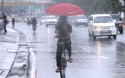
She said residents of these areas must take precautions against flash floods and landslides during moderate to heavy rains.
Metro Manila and the rest of Luzon will have isolated light rains also due to the northeast monsoon.
The rest of the country will experience isolated rain showers caused by the easterlies.
Meanwhile, moderate to strong winds and moderate to rough seas will prevail over northern and central Luzon, and the eastern section of southern Luzon, the Visayas, and Mindanao.
Strong to gale force winds will be experienced over the northern and eastern seaboards of northern Luzon, eastern seaboards of central and southern Luzon, and the western seaboard of northern Luzon.
PAGASA advised fishing boats and other small sea vessels not to venture into the sea, and larger sea vessels are alerted against big waves.
Elsewhere, winds will be light to moderate with slight to moderate seas. (PNA)
