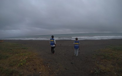
SOMBER. Overcast skies and occasional rainfall prevail over Gonzaga, Cagayan on Sunday (May 28, 2023) due to Typhoon Betty. Employees of the Municipal Disaster Risk Reduction and Management Office said they continue to go around the town to monitor residents and the state of evacuation centers. (Courtesy of Gonzaga MDRRMO)
MANILA – Betty has been downgraded from super typhoon to typhoon category as it decelerated moving westward over the Philippine Sea east of Northern Luzon as of 11 a.m. Sunday, according to state weather bureau Philippine Atmospheric, Geophysical and Astronomical Services Administration (PAGASA).
The center of the eye of Typhoon Betty was estimated based on all available data at 715 km east of Tuguegarao City, Cagayan province.
Betty is expected to gradually weaken until Tuesday and may be downgraded to severe tropical storm category on late Thursday or early Friday, according to PAGASA.
The typhoon will likely become slow-moving to almost stationary by Tuesday while over the waters east of Batanes. It will then move northward or north northeastward by mid Wednesday or Thursday towards the sea east of Taiwan.
Tropical Cyclone Wind Signal No. 1 remains hoisted over Batanes, Cagayan including Babuyan Islands, Isabela, Apayao, Ilocos Norte, the northern and central portions of Abra (Tineg, Lacub, Lagayan, San Juan, Lagangilang, Licuan-Baay, Malibcong, Danglas, La Paz, Dolores, Tayum, Bucay, Sallapadan, Daguioman, Bucloc, Boliney), Kalinga, the eastern and central portions of Mountain Province (Sadanga, Barlig, Natonin, Paracelis, Bontoc), the eastern and central portions of Ifugao (Mayoyao, Aguinaldo, Alfonso Lista, Banaue, Hingyon, Lagawe, Lamut, Kiangan, Asipulo), the northern and central portions of Aurora (Dilasag, Casiguran, Dinalungan, Dipaculao), Quirino, and the northeastern portion of Nueva Vizcaya (Kasibu, Quezon, Solano, Bagabag, Diadi, Villaverde, Bayombong, Ambaguio).
Monsoon rains are possible over the western portions of Mimaropa and Western Visayas on Monday and over the western portions of Calabarzon, Mimaropa, and Western Visayas on Tuesday.
A marine gale warning remains in effect over the northern and eastern seaboards of Northern Luzon, eastern seaboards of Central and Southern Luzon, and the eastern seaboards of Visayas and Mindanao. (PNA)
