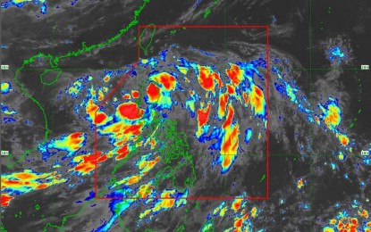
(Satellite image from PAGASA)
MANILA – Rainy weather and gusty winds will continue over Luzon on Friday due to Tropical Depression (TD) Dodong and the enhanced southwest monsoon.
The Philippine Atmospheric, Geophysical and Astronomical Services Administration (PAGASA) said Dodong made landfall in Dinapigue, Isabela at 3 a.m. Friday.
In its 8 a.m. bulletin, the weather bureau said Dodong was last tracked in the vicinity of Lasam, Cagayan, moving north-northwestward at 25 kph.
The TD packs maximum sustained winds of 45 kph near the center and gustiness of up to 75 kph.
Tropical cyclone wind signal (TCWS) No. 1 has been hoisted over Cagayan, Isabela, Apayao, Kalinga, Abra, Mountain Province, Ifugao, Benguet, Ilocos Norte, Ilocos Sur, La Union, and the northern portion of Pangasinan (San Nicolas, San Manuel, Sison, San Fabian, Pozorrubio, Bolinao, Bani, City of Alaminos, Sual, Labrador, Lingayen, Agno, Binmaley, Dagupan City, San Jacinto, Mangaldan, and Anda).
Strong breeze to near gale strength winds are likely in these areas.
Gusty conditions due to the southwest monsoon may also be experienced in Mimaropa, Bicol Region, Western Visayas, Calabarzon, Metro Manila, and other areas of Central Luzon where wind signal was not hoisted.
PAGASA said moderate to rough seas will prevail over the eastern and western seaboards of Northern Luzon, and the western seaboards of Central and Southern Luzon.
Mariners of small sea craft are advised to take precautionary measures when venturing into the sea.
"If inexperienced or operating ill-equipped vessels, avoid navigating in these conditions," PAGASA added.
Dodong is forecast to reach the tropical storm category by Saturday night and exit the Philippine Area of Responsibility either Saturday or Sunday. (PNA)
