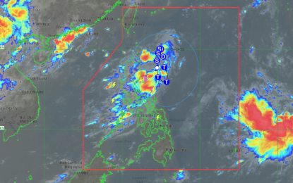
Track of Tropical Depression Goring (Image courtesy of PAGASA)
MANILA – A low pressure area (LPA) over the Philippine Sea east of Aparri, Cagayan has developed into Tropical Depression Goring, the weather bureau said on Thursday.
In its 5 a.m. advisory, the Philippine Atmospheric, Geophysical and Astronomical Services Administration (PAGASA) said the center of the tropical depression was located 400 kilometers east northeast of Aparri.
Goring is slowly moving west northwestward with maximum sustained winds of 55 kph near the center and gustiness of up to 70 kph.
PAGASA said Goring is less likely to bring heavy rainfall over the country in the next three days.
“However, considering the proximity of the tropical cyclone to land, any westward shift in the track forecast may result in heavy rainfall over portions of Cagayan Valley in the next three days,” it added.
The hoisting of Tropical Cyclone Wind Signals over areas in Northern Luzon may begin Thursday night or Friday “in anticipation of the onset of tropical cyclone severe winds.”
“Goring is forecast to steadily intensify throughout the forecast period and may reach tropical storm category tonight or tomorrow early morning. It may be upgraded into a typhoon category by Sunday during the southward segment of its looping track,” PAGASA said.
The tropical cyclone may also enhance the southwest monsoon beginning Sunday or Monday, it added.
Cagayan Valley and Cordillera Administrative Region will have cloudy skies with scattered rain showers and thunderstorms due to trough of Goring.
Visayas, Mimaropa, Bicol Region, Zamboanga Peninsula, Northern Mindanao and Bangsamoro Autonomous Region in Muslim Mindanao will also experience cloudy skies with scattered rain showers and thunderstorms due to southwest monsoon.
The weather bureau warned that possible flooding or landslides may occur due to moderate with at times heavy rains.
Metro Manila and the rest of the country will have partly cloudy to cloudy skies with isolated rain showers or thunderstorms due to southwest monsoon and localized thunderstorms.
The northern and western sections of Luzon will experience light to moderate winds heading southwest to west with slight to moderate seas.
The rest of the country will have light to moderate wind blowing south to southwest with slight to moderate coastal water.
The temperature ranges from 24.9°C to 32°C. (PNA)
