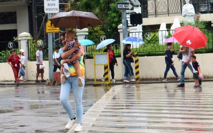
DRENCHED. Continuous heavy rains batter Davao City on Jan. 30, 2024. The low pressure area's trough affecting Mindanao will bring scattered to widespread rains and thunderstorms in Caraga, Davao Region and Soccsksargen. (PNA photo by Robinson Niñal Jr.)
MANILA – Most areas in the country will continue to experience rain showers Thursday due to the trough of a low pressure area (LPA) and the northeast monsoon or "amihan", the weather bureau said.
The LPA's trough affecting Mindanao will bring scattered to widespread rains and thunderstorms in Caraga, Davao Region and Soccsksargen.
Heavy to intense rains may cause flash floods or landslides in those areas, the Philippine Atmospheric, Geophysical and Astronomical Services Administration (PAGASA) said.
Scattered rain showers and thunderstorms also due to the LPA's trough are forecast over Central Visayas, Southern Leyte and the rest of Mindanao.
Moderate to heavy rains in those areas may result in flash floods or landslides.
PAGASA forecaster Benison Estareja said an LPA was spotted outside the Philippine Area of Responsibility, 195 kilometers southwest of General Santos City.
"It has a slim chance of developing into a tropical cyclone. It could possibly dissipate in the next few days," he said.
Meanwhile, “amihan” will bring light rains over Aurora, Quezon, and Bicol Region, and isolated light rains over the rest of Luzon.
The rest of the Visayas will have isolated rain showers caused by localized thunderstorms.
Moderate to strong winds and moderate to rough seas will prevail across the archipelago, PAGASA said. (PNA)
