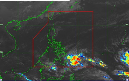
Satellite image shows the track of tropical depression "Chedeng" as of 8:40 a.m. on March 18, 2019. (Courtesy of PAGASA)
MANILA — Tropical Depression Chedeng has slightly slowed down but has maintained its strength as it moves towards east of Davao City on Monday.
In its 5 a.m. severe weather bulletin, the Philippine Atmospheric, Geophysical and Astronomical Services Administration (PAGASA) said the center of "Chedeng" was estimated at 650 km. east of Davao City. It is expected to make landfall over the eastern coast of Davao Oriental on Tuesday morning.
"Chedeng" is moving west at 15 km. per hour (kph) with maximum winds of 45 kph near the center and gustiness of up to 60 kph.
PAGASA hoisted tropical cyclone warning signal number 1 in the following areas:
- Davao Oriental
- Compostela Valley
- Davao del Sur
- Davao City
- Davao Occidental
- southern part of Davao del Norte, including Samal Island
- eastern part of North Cotabato and eastern part of Sarangani
The Davao region will experience rains with gusty winds. Scattered, to at times widespread moderate to heavy rains will prevail over Surigao del Sur, Agusan del Sur, Davao Oriental, Compostela Valley, and Davao del Norte; and in most parts of Mindanao on Tuesday.
Northern Mindoro will have cloudy skies with scattered rain showers and thunderstorms.
Batanes will have cloudy skies with light rains due to the northeast monsoon. Metro Manila and the rest of Luzon will have cloudy to cloudy skies with isolated rain showers caused by localized thunderstorms.
Temperature in Metro Manila will range from 23 degrees to 32 degrees Celsius; Tuguegarao City, 22-31 degrees Celsius; Baguio City, 15-21 degrees Celsius; Metro Cebu, 24-29 degrees Celsius; and Metro Davao, 24-30 degrees Celsius. (PNA)
