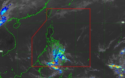
Satellite image shows the track of tropical depression "Chedeng" which has weakened into a low pressure area after it made landfall over Malita, Davao Occidental on Tuesday morning. (Courtesy of PAGASA)
MANILA — Tropical Depression Chedeng on Tuesday made landfall over Malita, Davao Occidental but has weakened into a low-pressure area (LPA).
In its 8 a.m. severe weather bulletin, the Philippine Atmospheric, Geophysical and Astronomical Services Administration (PAGASA) said "Chedeng" made landfall at about 5:30 a.m.
All tropical cyclone warning signals have been lifted. However, scattered, to at times, widespread moderate to heavy rains will still be experienced over Surigao del Sur, Agusan del Sur, Davao region, Soccsksargen, and portions of northern Mindanao, Bangsamoro and Zamboanga Peninsula.
At 7 a.m., the LPA was estimated in the vicinity of Malungon, Sarangani.
Metro Manila and the rest of Luzon will have partly cloudy to cloudy skies with isolated rain showers due to localized thunderstorms.
Those with small seacraft are advised not to venture out over the eastern seaboards of the Visayas and Mindanao.
Temperature in Metro Manila will range from 23 degrees to 34 degrees Celsius; Tuguegarao City, 23-33 degrees Celsius; Baguio City, 15-24 degrees Celsius; Metro Cebu, 25-30 degrees Celsius; and Metro Davao, 23-29 degrees Celsius. (PNA)
